ToltHawk Sensor.
Low-cost, self-contained, wireless sensors for real-time monitoring of floods, streams, rivers, lakes, sewer lines, and sewer lift pump stations. Easy to deploy in the field. Data via cellular, satellite, or LoRa.
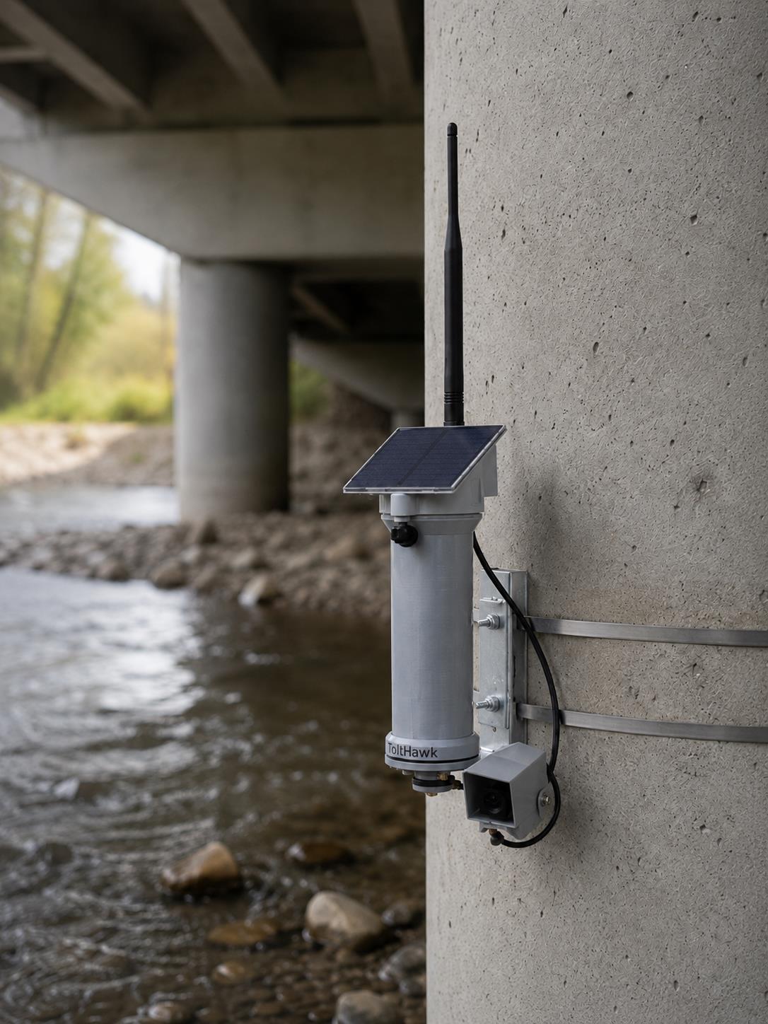
The third generation of ToltHawk Level Sensors works maintenance-free for 5 to 10 years.
Engineered for the field.
Wireless Data Transmission
Cellular (AT&T, Verizon, T-Mobile auto-switching in US, plus 150+ countries), satellite for remote sites, or LoRaWAN for areas without cellular coverage.
Maintenance-Free Operation
5 to 10 years of field operation without maintenance. Solar-charged battery keeps running for many months without sunlight.
Easy Installation
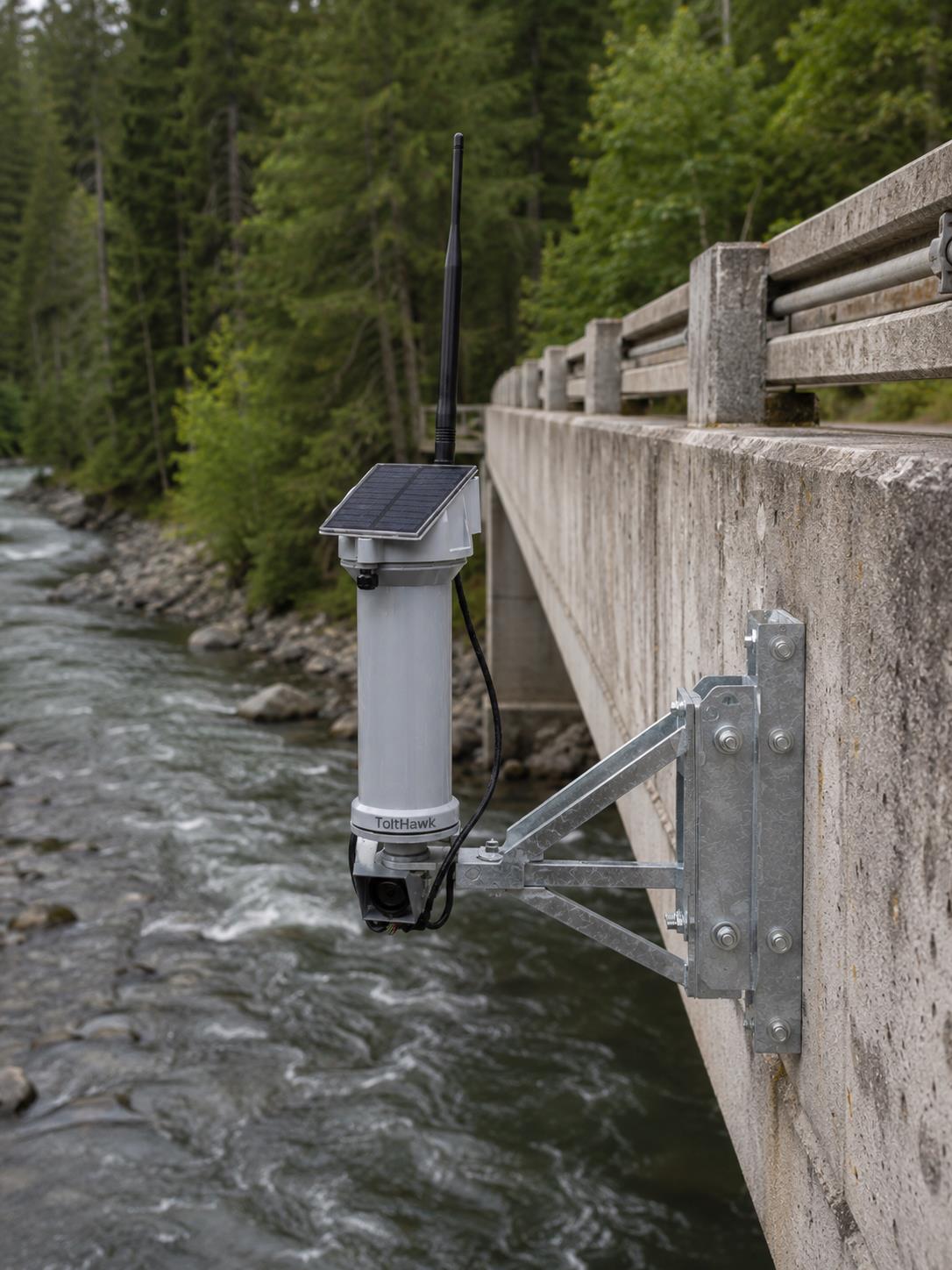
Self-contained units typically install over bridges or via cantilever. No wiring, no calibration, no special engineering. Mount vertically and the device starts transmitting automatically.
Configurable Alerts
Phone, text, and email notifications when configurable thresholds are reached. Set multiple alert levels per location.
JSON API
Integrate sensor data into your own systems and dashboards via REST API.
External Data Integration
Automatically pulls in NOAA weather, precipitation, in-basin USGS gauges, and LiDAR contour data.
Specifications at a glance.
- Measurement range15 cm – 20 m (0.5 ft – 65 ft)
- Radar beam angle3°–7° (narrow, pinpoint sensing)
- Update frequency15 min standard (USGS-aligned), configurable 15 min – 3 hr
- Sampling frequencyDown to 5 min (battery impact below this)
- PowerBattery + solar; multi-month operation without sun
- Service life5–10 years maintenance-free
- ConnectivityCellular (AT&T / Verizon / T-Mobile auto-switch), Satellite, LoRaWAN
- CalibrationSelf-calibrating; no calibration required after install
- OriginMade in USA (some parts from China and Switzerland)
Coverage everywhere you need it.
Cellular
Auto-switching across AT&T, Verizon, and T-Mobile in the US, plus coverage in 150+ countries.
Satellite
For remote installations without cellular coverage. Deploy anywhere on Earth.
LoRaWAN
For sites without cellular coverage but within range of a LoRaWAN gateway.
Extend the sensor.
Camera Module
Live pictures and videos of the target area (cellular only — satellite units record onsite for later retrieval).
External Sensor Connectors
Compatible with additional sensors for temperature, precipitation, conductivity, turbidity, and more.
Submersible Transducers
For below-grade and submerged installations alongside the standard radar unit.
Triggered Output Devices
Activate flashing road signals, sirens, or other field devices when alert thresholds are crossed.
Answers from the field.
Do I need to calibrate after installation?
Who installs the sensor?
How often does the sensor measure?
What's the measurement range?
Do you have an API?
Can I make my data public?
How do alerts work?
Where do you ship?

Specify the sensor
your deployment deserves.
See live data, talk through your environment, and get a unit configuration tailored to your monitoring needs.